This is the second of three posts about my adventures in Peru and Bolivia. You might also be interested in my short stop in Lima or visit to Potosí and Uyuni in Southern Bolivia.
I woke up when the wheels hit the tarmac at El Alto International Airport. At 13,323 feet (4,061 m) above sea level it is the highest altitude airport outside the Chinese Himalayas. Even with full brakes and reverse thrust, the plane seemed to just keep rolling. I walked through Customs just before 5am in a disheveled suit and hauling a massive duffle bag of mountaineering equipment. My dad had come up by taxi to greet me.
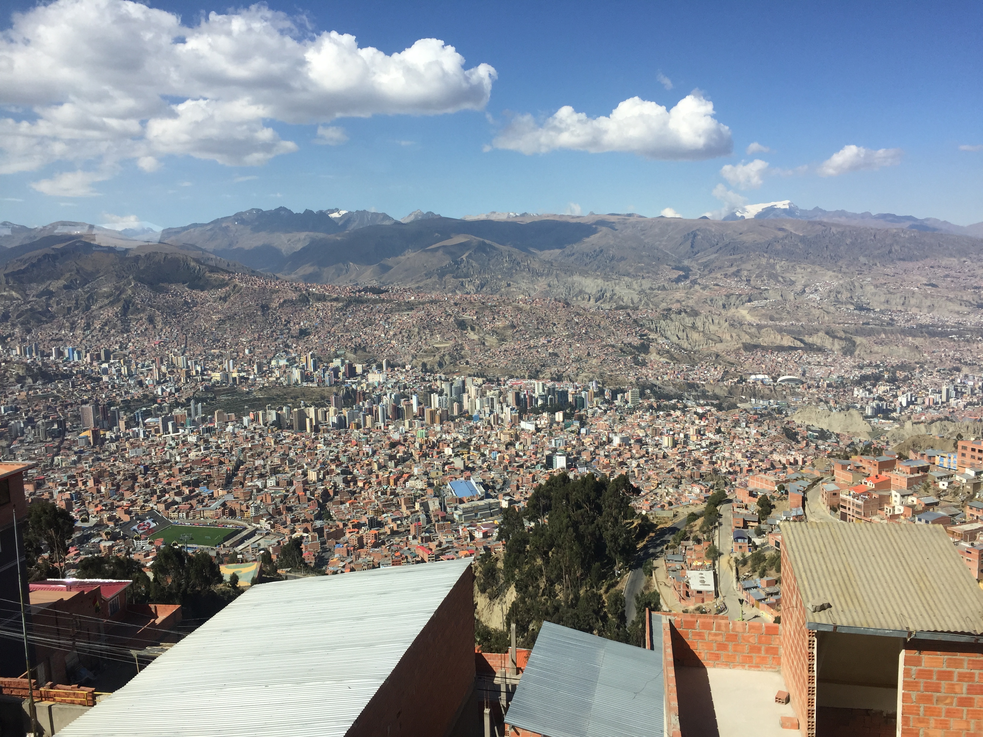
La Paz, Bolivia’s de-facto capital, sits in a deep, high-altitude canyon. On the plain above lies its larger neighbor, El Alto. The extreme topography and climate at this altitude make for a strange city. Instead of living on the hills with their fantastic panoramas, the wealthiest citizens of La Paz live as far down the canyon as possible where the climate offers less wind and warmer temperatures. The city’s poorest citizens live on the windy, harsh and cold plain of El Alto.

Until the last few years, the citizens of El Alto had to make a grueling commute by collectivo – public minibus – from the high plain down to their workplaces in La Paz. The roads snake down the walls of the canyon in deadlocked traffic. This inefficient system has since been augmented by the teleferico – a cable car system that now shuttles passengers all over the city. While many cities incorporate a cable car into their public transportation networks, La Paz/El Alto is the only city with an interconnected network. At 50 cents a ride, it’s both an economical and scenic way to see the city. I rode every line in the city, most of them just for fun.
As interesting as I found La Paz, my real objective in Bolivia was the summit of Huayna Potosi, a high peak to the north. We found a tour company that was willing to provide a cook and a guide for the weekend, and on Saturday morning we set out for base camp.
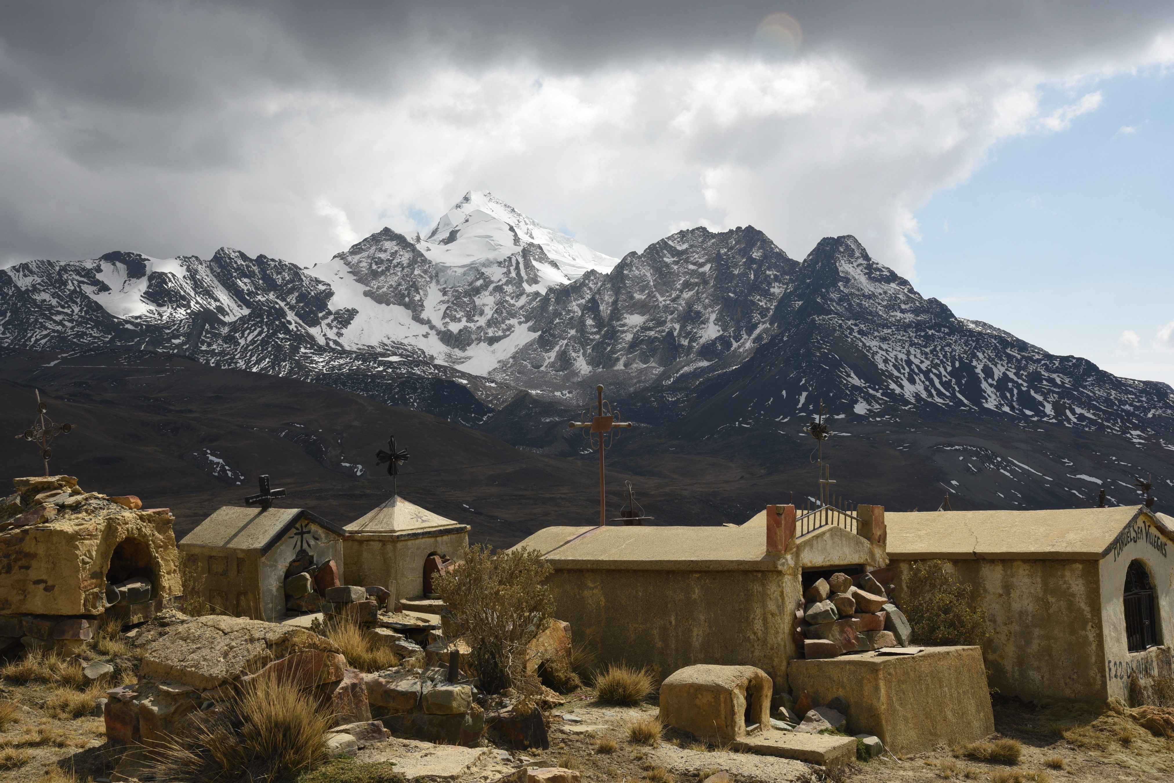
We bounced along the dirt road to base camp for an hour, eventually reaching a police checkpoint. At the mountain cemetery nearby, my dad snapped a photo of the graves with the mountain towering behind. After dropping most of our gear at the base camp hut near Lago Zongo, we put on smaller packs and headed to the glacier for some practice.

Hiking towards the glacier / Greg Schenewerk 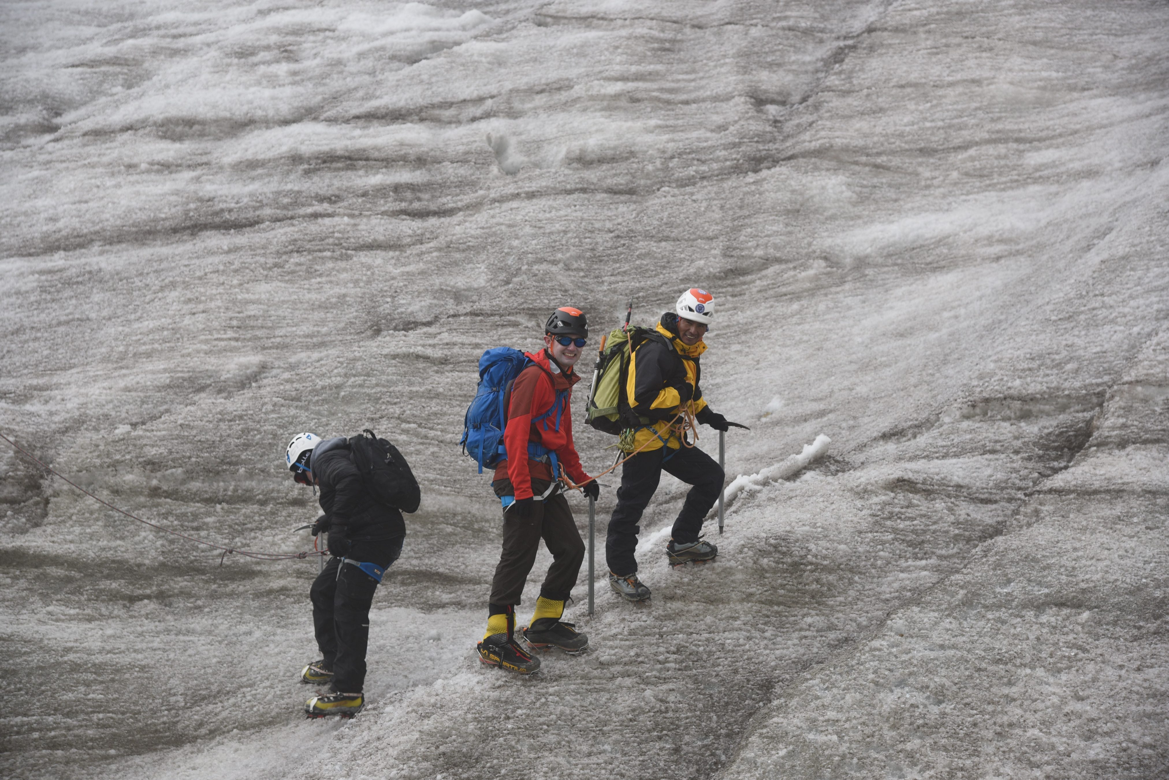
My guide and I pass an unsteady climber wearing crampons for the first time / Greg Schenewerk
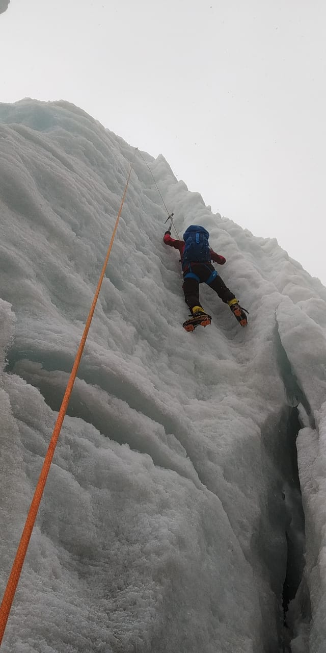
My guide put me through my paces, but after seeing that I was proficient with crampons, we moved on to vertical ice. Using his two heavy ice tools, I climbed my first pitch of vertical ice.
We descended back to where we had left my dad, who had spent the time taking selfies on the glacier as a light snow fell. Together, the three of us descended back to the base camp hut to enjoy a hearty dinner and get some rest.
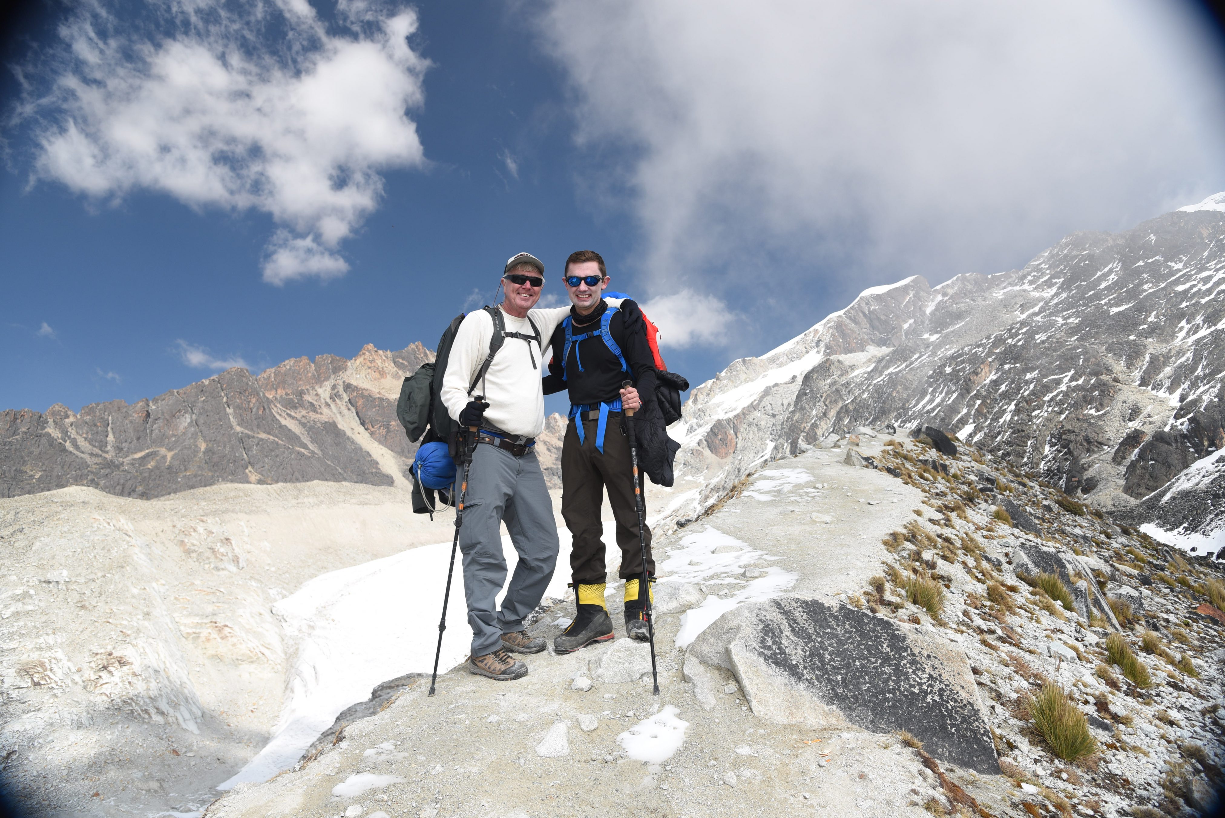
The next morning we left all unnecessary equipment behind and started our ascent to the high camp – a hut perched atop a rock outcrop. After passing the glacier where we had practiced the previous day, every step marked the highest my dad had ever climbed. We passed fifteen, then sixteen thousand feet before dropping our bags at the hut.
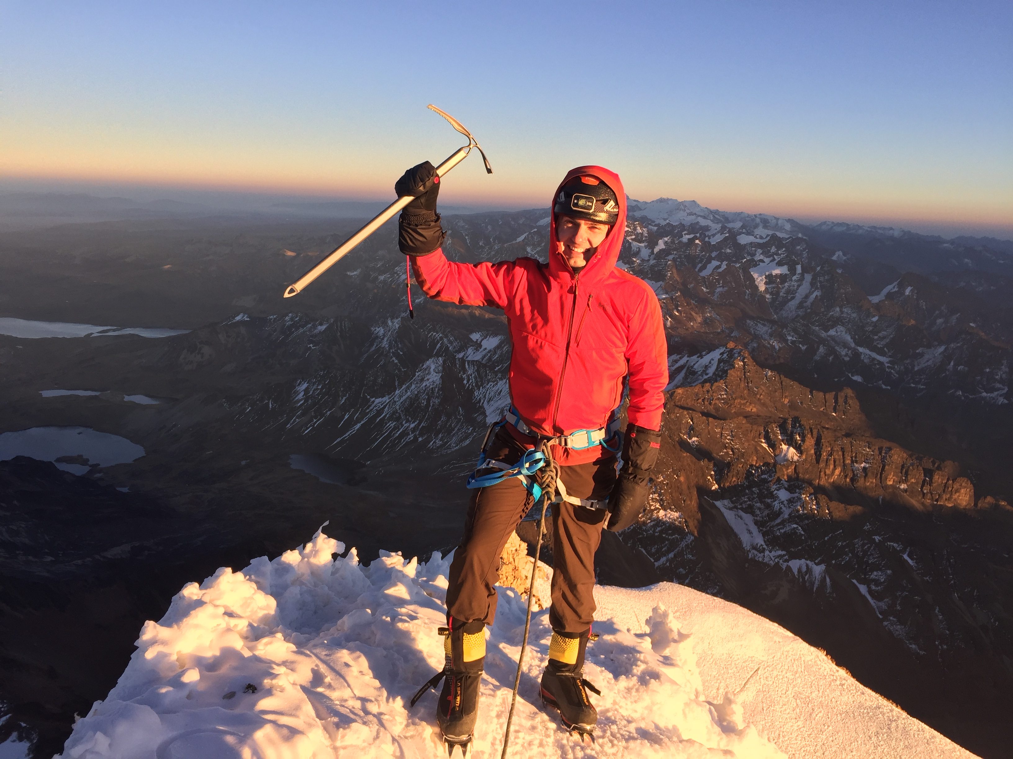
Our amazing cook, Abel, made us dinner after we had taken some photos, and we almost immediately headed for our sleeping bags for a cold night’s sleep. My alarm went off at 1am and I pulled on my fleece pants, jacket, and backpack. Dad snapped a photo of us as we set off for the summit.

My guide, Andres, tried to hold me to a slow, plodding pace, but when I was leading the climb I couldn’t help but climb a bit faster. I had had little time to acclimatize, and it quickly drained my strength.
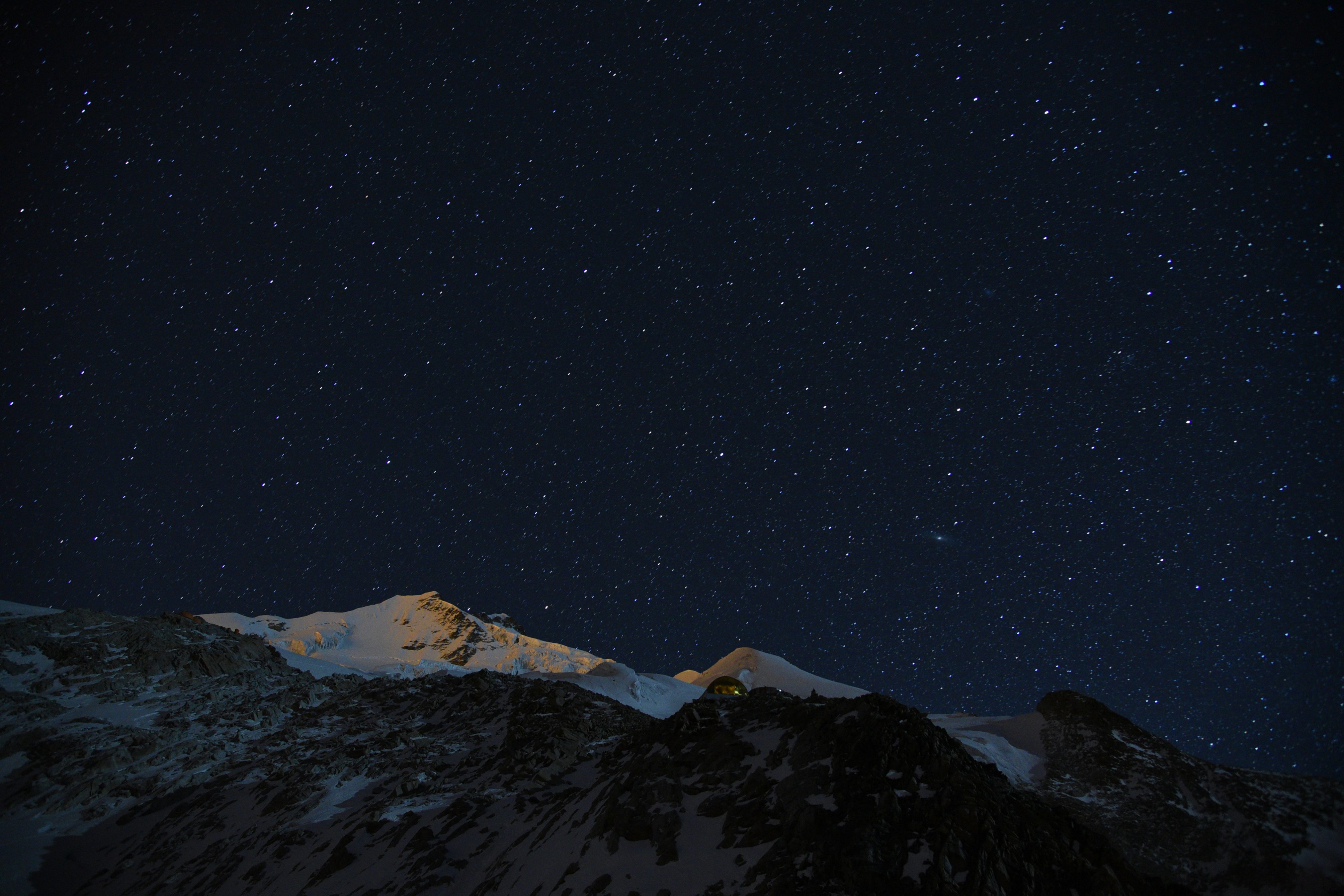
As my dad set up his camera in the cold to take a series of time lapse photos of the stars, Andres and I climbed over the glacier. We made a few brief stops before crossing the bergschrund – the most technically challenging section – and reached the base of the headwall about dawn. In the end, he Andres proved his experience – I struggled the last hundred meters to the summit. But after expending all that effort, I stood atop the summit of Huayna Potosi at 6,088 meters (19,974 feet).
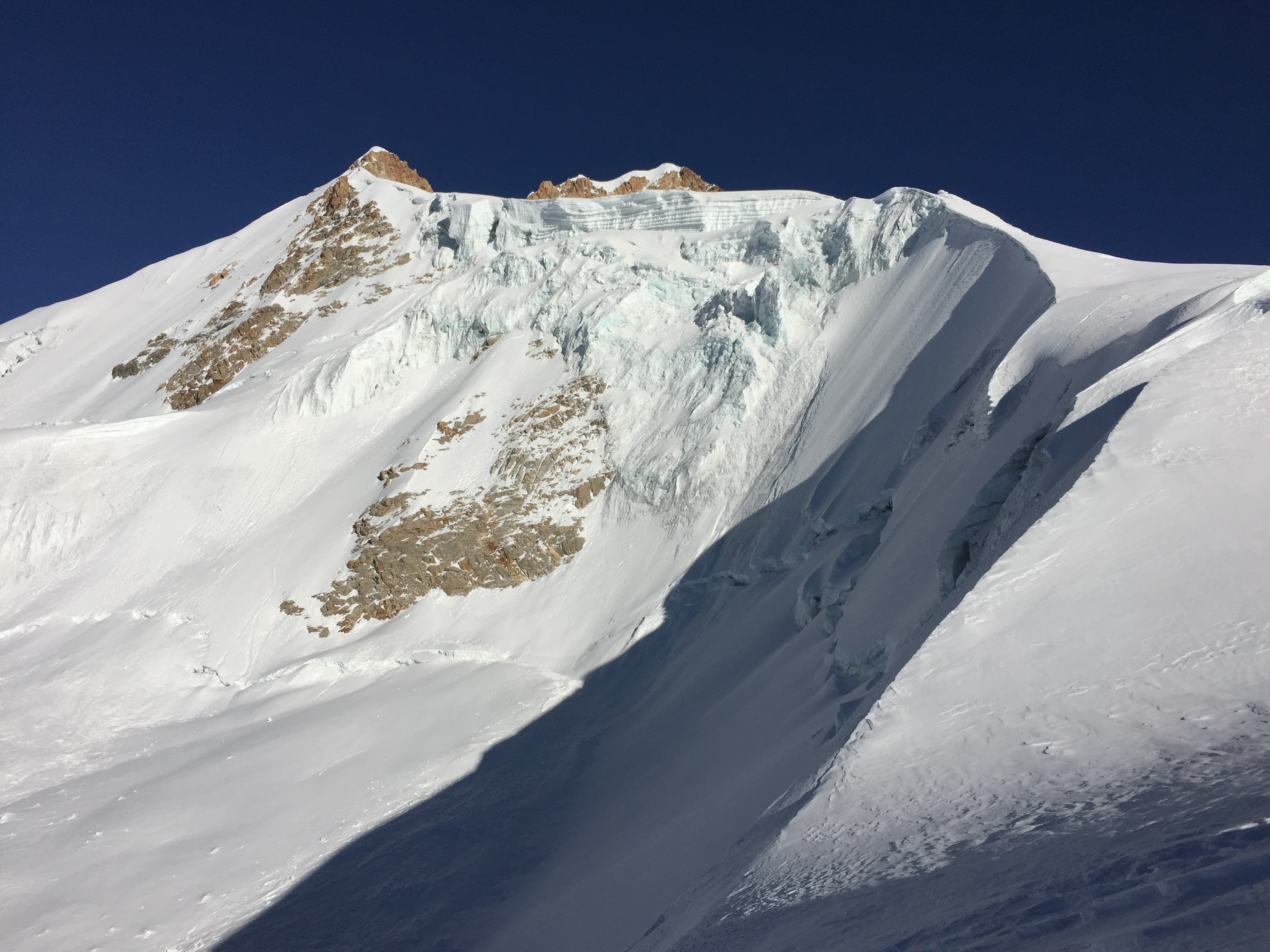
We descended in daylight, which provided more opportunities for photos of the glaciated terrain.
Before 9am, we greeted my dad at the hut and ate another one of Abel’s delicious meals. I pulled off my climbing boots and steam rose off my feet in the cold air. Luckily I could trade my wet socks for dry before we started to descend the mountain. By noon we were back at base camp, and by 2pm I was in the hotel room, answering a backlog of emails from the office.